

Earth & Climate • SOMOSPIE
SOMOSPIE: transforming coarse Earth observations into fine-resolution soil moisture intelligence through AI
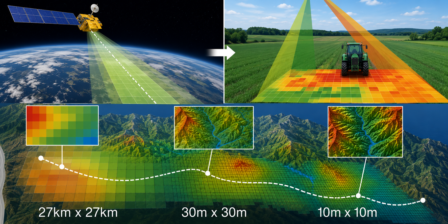
Soil moisture shapes crop health, wildfire risk, water availability, and ecosystem behavior, yet satellite observations are often too coarse or incomplete for local decision-making. SOMOSPIE combines satellite measurements with terrain, climate, and environmental data to generate fine-resolution soil moisture predictions. Through NSDF, these distributed datasets and machine-learning workflows become easier to access, execute, visualize, and reuse across computing environments.
The Scientific Challenge
Soil moisture varies significantly over short distances because of elevation, slope, sunlight, drainage, vegetation, and local climate. Satellite products provide broad coverage, but their coarse resolution cannot capture these local patterns directly. Researchers must integrate heterogeneous observations and terrain variables, fill spatial gaps, and transform coarse measurements into predictions detailed enough to support regional and local analysis.
How NSDF Helps
NSDF connects SOMOSPIE with public environmental datasets, scalable computing, persistent storage, workflow automation, and interactive visualization. The workflow gathers soil moisture observations, generates terrain features with GEOtiled, trains prediction models, and publishes fine-resolution outputs for further analysis. Reusable containers, notebooks, and Pegasus workflows make the process portable and reproducible across cloud and high-performance computing resources.
Scientific Impact
SOMOSPIE transforms coarse environmental observations into high-resolution soil moisture information that is more useful for precision agriculture, hydrology, environmental monitoring, and wildfire preparedness. By combining machine learning with scalable data and workflow services, researchers can investigate soil-water patterns across larger regions and at finer spatial scales than satellite observations alone permit.
Key Outcomes
- Fine-Resolution Predictions — Converts coarse satellite observations into detailed soil moisture maps for regional and local analysis.
- AI-Powered Integration — Combines soil moisture, terrain, climate, weather, and field observations within a unified prediction workflow.
- Reproducible Modeling — Packages data generation, transformation, and prediction as reusable notebooks, containers, and Pegasus workflows.
- Environmental Decisions — Supports applications in agriculture, hydrology, wildfire preparedness, and ecosystem management.